AN HISTORIC WALK AROUND CHARLESTOWN
The circular walk will take you about 2 hours (not including stops at the Stubbing Wharf Hotel) or 3 hours with kids doing the walk. Most of it is on the flat with two fairly short hilly sections. Most of the walk is also on tracks, but one or two spots may be muddy after rain.
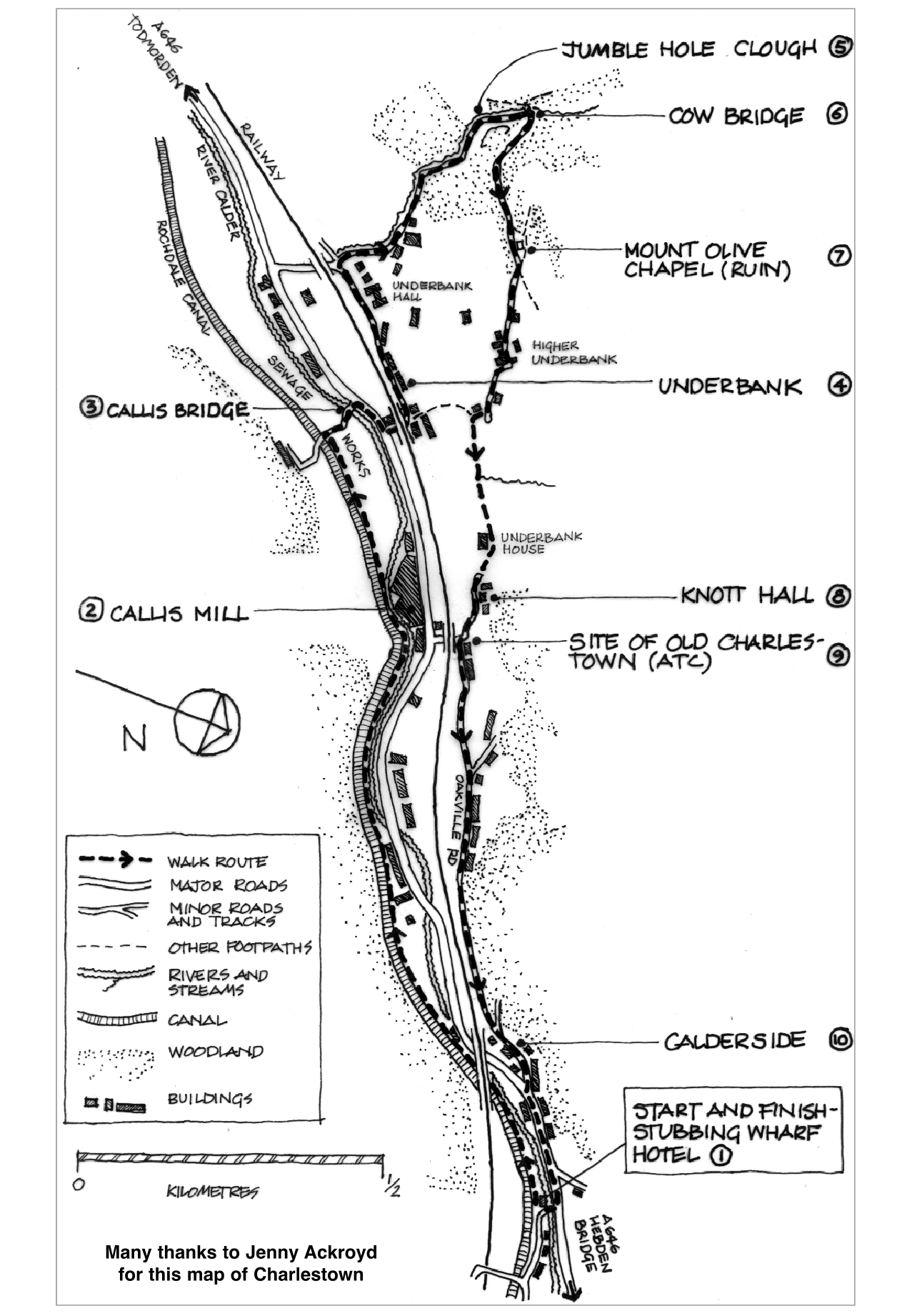
If you want to do the walk, download the pdf file of the map at the bottom of the page. The points marked on the map below are points of interest which are explained on the accompanying notes. Further explanation about these can be found on the various web pages.
The walk starts at the STUBBING WHARF HOTEL (marked 1 on the map). To get to the Stubbing from Hebden Bridge, walk west along the canal towpath for about 10 minutes (or take the Todmorden bus getting off at Bankfoot stop and walking 100 yards farther).
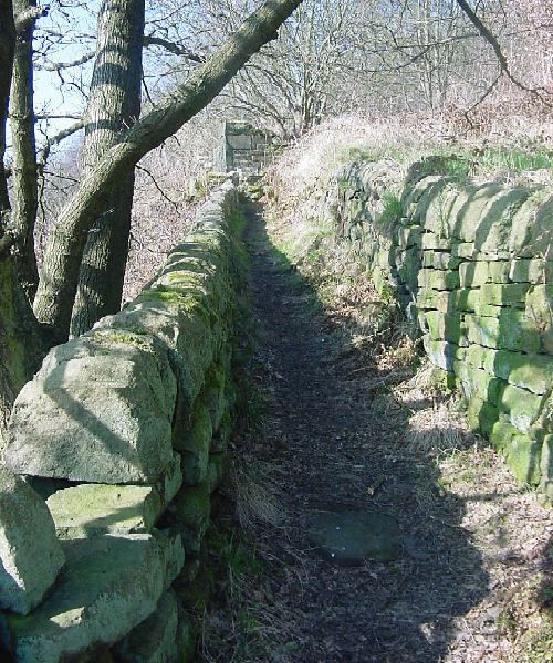
From The Stubbing, carry along the towpath for about 15 mins to Callis (formerly Calais) Wood Bottom Lock passing a cluster of houses after which the river joins you on your right. At the lock, the buildings on your right are what remains of the weaving sheds and offices of CALLIS MILL (marked 2 on the map).
Carry on along the towpath for about 5 mins and turn off to the right just before the bridge. Follow the track over CALLIS BRIDGE (marked 3 on the map). Across the road, to your right you will see a small house called Dover with a railway arch to its right.
Go across the main road (take care!) and under the railway arch to UNDERBANK (marked 4 on the map). The first house on your right is Lacey House which was built in 1793. Turn left along Underbank Avenue with the railway on your left. Half way along you will see a large stone dwelling which is Underbank Hall built in 1788.
At the end of Underbank Avenue, you will come to a cross-roads, where you turn right up the track to JUMBLE HOLE (marked 5 on the map). The first mill you come to is Jumble hole mill, which was a dyeworks. Carrying on up the track, you will see some ivy covered ground on your left, where believe it or not there were ten dwellings. Opposite, you will see some stonework on your right, this is all that remains of the five storey Spa Mill that started life as a water-mill.
A little farther and the track and you reach COW BRIDGE (marked 6 on the map) where the track turns up to the right. Beneath the bridge you can see the weir that feeds a disused mill dam. The remains of Cow Bridge Mill can be seen on the far side of the river (late 18th century, used for worsted and cotton spinning).
A COUPLE OF SHORT DETOURS
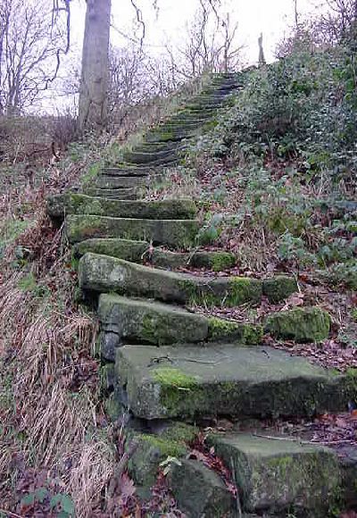
If you are inclined there are a couple of short (2 or 3 minute) detours you can take from Cow Bridge. Crossing Cow bridge follow the track up to the left after a few yards you reach a sharp right hand bend, follow the small path straight ahead, after 30 yards the path ends and you can see the biggest set of stone steps you have ever seen. The steps were built to bring workers from the tops down the mills in Jumble Hole Clough (if you are really fit, climb the steps to the top for a fine view of Jumble Hole Clough).
For the second detour, double back down the path to rejoin the track and follow it upwards for twenty yards. On your right you will see a mill dam which fed Cow Bridge Mill and which Harry Greenwood used to construct his home made hydro electric scheme.
Back down to Cow Bridge, follow the main track up the hill and after about 5 mins you will come to MOUNT OLIVE CHAPEL (marked 7 on the map). The Chapel is semi derelict, but many of the Gravestones are intact.
Keep along the track (you are now on the Pennine way with a fine view of Sandbeds which is the posh name of the sewage works!) passing a cluster of houses including Higher Underbank and Nabby Nook. The track narrows to a path and starts to go down hill. After a few yards you come to another house on the right called Lacey (formerly Lashey) Laithe where you leave the Pennine Way and turn left along a small footpath.
Follow this path across a small clough, behind Underbank House and in front of KNOTT HALL (marked 8 on the map).
After a few yards, the cobbled track emerges on to a road called Stoney Lane, where you turn left up the hill.
The Air Training Corps hut immediately on your left is the site of OLD CHARLESTOWN (marked 9 on the map). Believe it or not 50+ people lived on this site. The terrace on the hill contains the site of Holts Botanical Brewery.
At the top of the rise you follow the single track Oakville Road eventually joining up with the railway line. At the bottom there two terraces of houses and a strange looking building on the right. This was the mill office and is all that remains of the mill at CALDERSIDE (marked 10 on the map).
Calderside joins the main road and THE STUBBING (marked 1 on the map) is 100 yards towards Hebden Bridge.
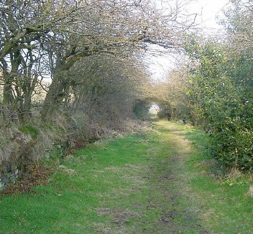
PATHS AND TRACKS
There are many wonderful old paths in Charlestown and Eastwood, so we have created this section to show some examples and describe some of the stories about them.

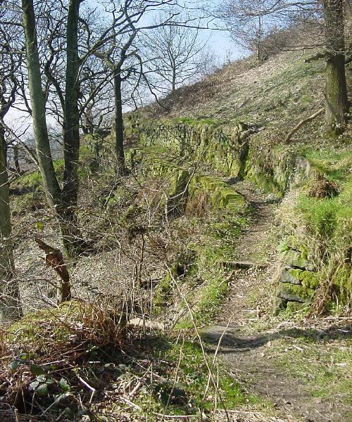
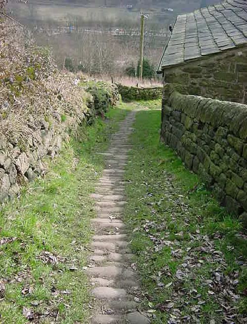

STEPS
Several of the paths include magnificent stone steps which were used by mill workers to get from the tops to the mills. these are a feat of 19th century (or perhaps even earlier) construction, so we have created this section to show some examples.

These are probably the finest set of steps in the upper valley. They were presumably built to get people living on the tops down to the mill.


This page was last updated April 2009